Over the 4th of July weekend we headed to a 'secret' lake that Connor had camped at before for a few days of relaxing and swimming. . It shall go unnamed so we don't piss off the locals. In fact, hiking into the lake we passed someone on the trail who asked where we were going and I told him where. He said "we don't say that name out loud." We also decided to summit Olallie Butte to check out the view!
The journey from our campsite to the trail head was only a mile or so by dirt road. Gina, Goose, Amanda and Connor in the back of Brad's truck.
The trail is mostly on Warm Spring Reservation land and is apparently not maintained. We found it to be in great condition though with only one or two logs to step over.
Most of the trail looks like this- a pleasant walk through the trees without too much grade. Despite being nearly 2600 feet in elevation grade over 4 miles to reach the summit there really isn't any spots I would consider steep.
Entering Warm Springs land.
Our first view of the hike. Looking north to Mt. Hood.
Brad, Connor and Goose in a bee filled meadow we passed through.
A view of the secret lake we were camped at.
A great view of Mt. Jefferson. The short and spindly trees tell their tales of rough winters.
Looking to the summit. We were in the trees almost the entire way up. It opens up as you approach the end of the trail.
Holy shit! A mountain goat friend gazing down at us! WTF! Despite seeing them on St. Helens and Three Fingered Jack this summer I did not expect to see one on Olallie. Cool!
A better look. We put Pearl and Goose on their leashes so they wouldn't give chase, but they never noticed. The goat wandered off before we got to the summit and we didn't see him again.
Amanda climbing the trail with Olallie Lake in the background.
On the summit we saw several places where it appeared a mountain goat was scratching themselves on branches and left behind fur. Very soft! Would make a nice coat or scarf.
The summit is a wide open flat area. Nothing technical here!
Great views all around including this shot of Jefferson. Jefferson Park is up there somewhere.
A cool arch feature on some exposed rock just below the summit.
The lakes below. We were told much of the dead trees are from beetle damage.
Looking across the summit to the foundation of the long gone fire lookout.
Brad thumbs upping. Happy 40th birthday weekend stud!
Gina makes fun of my adventure hat but I love it.
Looking east.
Group shot with Jefferson in the background. Connor, Brad, Seth, Gina, Amanda and Amanda. Happy 4th!
Fire lookout remains.
Mt. Hood with Adams and Rainier (?) further off.
Back at camp to do some swimming. The water was perfect and it was fun to fuck around on the logs.
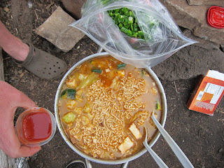
Deluxe ramen for duh duh.
Looking across the like to Olallie Butte. Despite the heat this hike was fantastic and the summit views were incredible. Despite Terry Richards opinion that this hike is "B-O-R-I-N-G" I highly recommend it. Great rewards for your work!


